
Camas ZIP Code Coverage
Camas uses 98607 as its primary standard delivery ZIP. The same postal area can include city addresses and nearby edge or rural delivery points, so it is not a city-limit polygon. USPS label information can also place 98671 beside Camas in a grouped result, yet the individual post-office records identify 98671 with Washougal. Nearby Clark County ZIPs may appear in parcel exports or map views without becoming Camas ZIPs.
| ZIP Code | Areas Covered | Post Office | Notes |
|---|---|---|---|
| 98607 | Camas standard delivery area and adjacent edge geography | Camas Post Office, 440 NE 5th Ave | Primary Camas ZIP; verify city limits separately |
| 98671 | Washougal standard delivery area | Washougal, 129 Pendleton Way | Appears in a USPS grouped label result, but is not a blanket second Camas ZIP |
| 98684, 98682, 98683, 98606, 98670 | Vancouver, Brush Prairie, and other nearby delivery areas | Corresponding local offices | Use only when USPS validates the complete address |
The official address-level answer comes from USPS, not from a shaded web map or a city name in a third-party dataset. The Camas office is listed at 440 NE 5th Avenue with the full label 98607-2031. That extra four-digit portion identifies a finer delivery segment. It does not create another area ZIP. A post-office box can use a Camas mailing identity while revealing nothing about its holder's physical location.
Why Camas Uses 98607
USPS identifies 98607 as the ZIP for the Camas Post Office and its standard delivery area. Historic downtown, the mill and riverfront setting, Lacamas Lake, Prune Hill, Grass Valley, and newer north and east development all supply useful local context, but those place names do not set postal boundaries. Validate a delivery point through the official lookup rather than assuming a neighborhood belongs wholly inside one polygon.
Research found no official public USPS polygon and no documented Camas-specific ZIP split or realignment year. That gap matters. A ZIP code directory should not invent a boundary history from unofficial maps. For a current answer, enter the street address and compare the returned city and ZIP with county parcel and city boundary records.
Camas and Washougal ZIP Labels
Camas and Washougal sit close enough that postal, court, newspaper, and service records can name the neighboring city without documenting a move. USPS grouped label data places 98607 and 98671 on a Camas line, while its separate location records assign the Camas and Washougal post offices their own standard ZIPs. Use 98671 only when the actual address validates it.
Keep four fields separate in research notes: event location, mailing locality, postal ZIP, and municipal jurisdiction. A Camas-Washougal newspaper notice may use a shared regional label. The municipal court is also in Washougal. Neither fact alone moves a Camas parcel into Washougal or changes the postal address.
Boundary check. Treat 98607 as the primary Camas ZIP and 98671 as an adjacent-address verification issue, not a second citywide Camas code.
Find Camas Residents by ZIP
A ZIP can narrow an address search, but the official Camas systems do not provide one public browser that lists all residents within it. USPS verifies delivery labels. Clark County PIC documents public searches by address, house number, tax account, and parcel. MapsOnline finds parcels and lets a user inspect nearby geography. The statewide voter extract contains address and district data under Washington law, but VoteWA is personal self-service rather than a public ZIP resident search.
- Validate the full street address with the official USPS search and save the postal city, five-digit ZIP, and ZIP+4 exactly as returned.
- Search the address or house number in Clark County PIC. Record the parcel, situs address, tax mailing field, and legal description without treating the owner as an occupant.
- Open MapsOnline by parcel or tax account to compare the location with municipal, district, or development boundaries shown in current layers.
- Use a lawful SOS voter-file request only when its permitted purpose fits. Filter the received data carefully, since the public portal is not a household browser.
Once the postal area narrows to a named road, the Camas street directory provides the street-level record chain. ZIP geography should remain the first filter, not the final claim about a person.
Verify a Camas ZIP Address
The USPS ZIP Code Lookup offers three useful paths: address to ZIP, city and state to ZIPs, and ZIP to associated cities. Use the first for a residence or parcel question. The second gives a broad postal list, while the third explains acceptable locality labels. USPS warns that a successful result does not confirm a person or company at that address.
| Search mode | Best Camas use | What it cannot prove |
|---|---|---|
| Street, city, and state | Confirm one complete delivery label and ZIP+4 | Current occupant or parcel ownership |
| City and state | Review ZIPs associated with a locality name | Exact municipal limits |
| Cities by ZIP | Check accepted postal city names | That every address lies in that city |
The assigned USPS screenshot failed during capture, so the successful Clark County PIC source supplies the documented address-search image for the next stage.
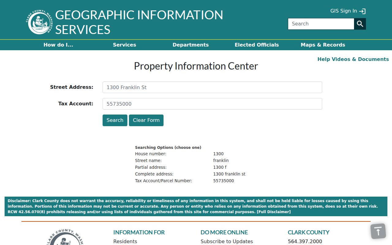
PIC connects the validated postal address to county property fields, which helps expose a city-limit or mailing mismatch.
Camas Parcels Beneath ZIP Codes
A parcel is the county tax and mapping unit. It is a stronger property key than a ZIP. PIC links an address with its tax account, parcel identifier, assessment, tax, recorded-document, and permit tabs. A situs address means the property's physical address. The separate mailing field is where tax correspondence goes and may belong to an owner who lives elsewhere.
Public PIC instructions do not promise a ZIP-wide filter. MapsOnline likewise emphasizes street, parcel, tax-account, Find Parcel, and Identify tools rather than a ZIP resident query. Search the validated address, then browse nearby parcels only when the task moves to street scale. If an export contains ZIP, inspect its current schema and date before treating that field as authoritative.
Note: A parcel, tax account, mailing address, and postal ZIP may describe related facts without identifying the same person or place.
Camas ZIP and Address Keys
Different custodians index the same place in different ways. Recorded deeds, easements, and plats rely on a legal description or document number. PIC and permit systems use parcel and street address. Printed directories use the street name as published that year. Voter registration uses a physical residence for precinct assignment. USPS controls the delivery label.
| Key | Use it with |
|---|---|
| Postal address and ZIP | USPS delivery verification |
| Situs and parcel | Clark County PIC and MapsOnline |
| Lot, block, or legal description | Recorded deeds, plats, and older land research |
| Residence and precinct | Voter records under state access rules |
Camas has directional prefixes and numbered roads in newer areas, while older downtown streets and named roads follow other patterns. Historical searches may also require La Camas or Vancouver-area headings. Do not infer a quadrant rule or rewrite an old address before checking the map and parcel account.
Camas ZIP Search Limits
A ZIP-wide total describes postal geography, not the population inside Camas. The 2020 Census city count and a City estimate use different dates or boundaries, while ZIP statistics use delivery geography. Preserve the source, date, and area definition instead of blending them. Census address tools can validate or geocode an address, but they do not name a resident.
Permit and code-case records can be searched by address. School zones and utility districts describe service areas, not named households. Vote records have statutory use limits, and protected voters do not expose an actual address. A post-office box also cannot be translated into a residence. These boundaries keep the ZIP code directory useful without turning a postal clue into an unsupported personal claim.
Camas ZIPs Versus City Limits
A postal-city name routes mail. It does not establish municipal jurisdiction. The City development map distinguishes city limits from the urban-growth boundary, while Clark County maps parcels and county data. An address can carry a Camas mailing identity near or beyond the city edge, and a Clark County parcel can use a neighboring post office. When USPS, PIC situs, and a current boundary map disagree, record all three and name the source for each value.
The same rule applies to a PO Box. It shows where mail is collected, not where the holder lives. ZIP+4 narrows a delivery segment, but it is still postal. A carrier route groups mail delivery stops. None of these replaces a parcel, legal description, or official city-limit layer.
- ZIP versus ZIP+4
- A five-digit ZIP covers a delivery area. The added four digits narrow a delivery segment, route, building, or box group.
- PO-box ZIP
- A code or ZIP+4 used for post-office boxes; it does not reveal the box holder's physical address.
- Unique ZIP
- A ZIP assigned to one high-volume organization rather than a general neighborhood. No such Camas ZIP was documented in the research.
- Carrier route
- A postal grouping of delivery stops used to organize mail, not a city boundary or resident roll.
That distinction is the core of an accurate Camas ZIP code directory. Postal, county, and city systems overlap, but each answers a different question.